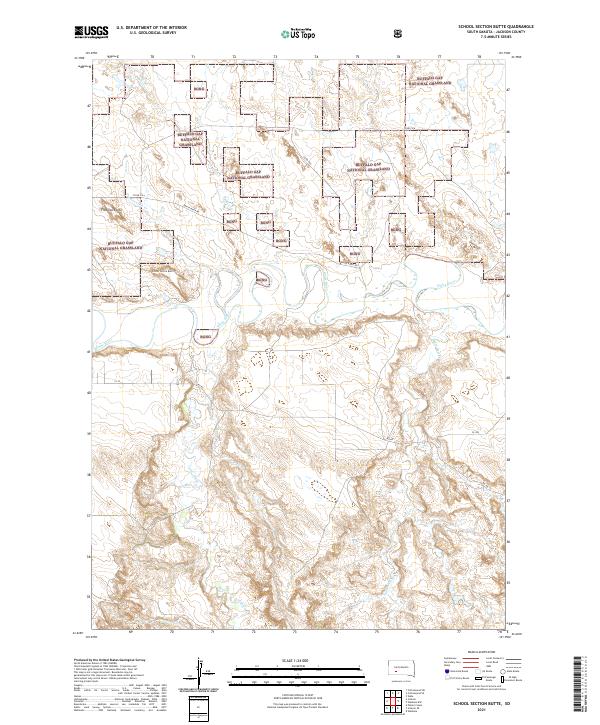
2021 Map of School Section Butte
USGS Topo · Published 2021About this map
The White River winds through this section of Jackson County, carving a serpentine path through the preserved acreage of the Buffalo Gap National Grassland. The landscape is defined by its distinct alluvial drainage patterns, with numerous tributaries such as Bear-in-the-Lodge Cr, Eagle Nest Cr, and Sixteenmile Cr feeding into the main river channel. Dominating the local topography are several prominent elevations, most notably School Section Butte and Flat Top Butte, which serve as significant landmarks in this expansive prairie environment.
Find a feature on this map
23 named features on this map. Tap any name to fly to it.
Don’t see what you’re looking for? This feature index may not catch every label — zoom into the map to look around manually.
Map Details
Editions of this 2021 School Section Butte Map
This is the sole edition of this map. No revisions or reprints were ever made.
Other maps of this area

1950 · Interior
USGS Topo · 1:24,000

1950 · Interior SE
USGS Topo · 1:24,000

1950 · Potato Creek
USGS Topo · 1:24,000

1950 · Wanblee
USGS Topo · 1:24,000

1950 · Weta
USGS Topo · 1:24,000

1951 · Wanblee NW
USGS Topo · 1:24,000

1951 · School Section Butte
USGS Topo · 1:24,000

1955 · Martin
USGS Topo · 1:250,000

1958 · Martin
USGS Topo · 1:250,000

1960 · Cottonwood SW
USGS Topo · 1:24,000