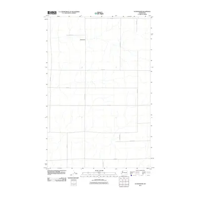
2011 Map of Schoonover
USGS Topo · Published 2011About this map
Schoonover anchors this rural landscape in Adams County, defined by a rigid grid of agricultural roads and seasonal watercourses. The territory reflects the organized land management typical of the Inland Empire, where the vast drainage networks of the Channeled Scablands influence the placement of transport and homesteads. Local routes such as E Arlt Rd, E Tokio Rd, and N Schoonover Rd divide the territory into distinct sections, while unnamed intermittent streams provide the only deviation from the straight-line geometry of the road network. This survey, published by the U.S. Geological Survey, illustrates the sparse but deliberate footprint of settlement in this portion of Washington. Researchers can trace the connection between family names and the local geography through thoroughfares like N Nielsen Rd, E Griffith Rd, and N Longmeier Rd, which serve as the primary infrastructure for this dry-land farming region.
Find a feature on this map
15 named features on this map. Tap any name to fly to it.
Don’t see what you’re looking for? This feature index may not catch every label — zoom into the map to look around manually.
Map Details
Editions of this 2011 Schoonover Map
This is the sole edition of this map. No revisions or reprints were ever made.
Other maps of this area

1953 · Ritzville
USGS Topo · 1:250,000

1959 · Ritzville
USGS Topo · 1:250,000

1965 · Ritzville
USGS Topo · 1:250,000

1967 · Reiman SW
USGS Topo · 1:24,000

1967 · Ritzville SW
USGS Topo · 1:24,000

1967 · Schoonover
USGS Topo · 1:24,000

1967 · Reiman
USGS Topo · 1:24,000

1967 · Ritzville NW
USGS Topo · 1:24,000
1967 · Reiman SE
USGS Topo · 1:24,000

1968 · Sylvan Lake
USGS Topo · 1:24,000