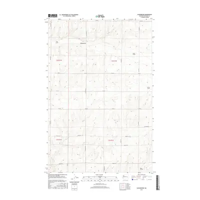
2017 Map of Schoonover
USGS Topo · Published 2017About this map
Schoonover anchors this portion of Adams County, where the landscape is defined by the distinct topographic depressions of the Inland Northwest. The area is marked by significant natural drainages including Rocky Coulee to the north and Bauer Coulee in the southeast. These geological features dictated the development of the local road network, which primarily follows the section lines of the Public Land Survey System. A dense grid of rural corridors, such as Tokio Rd, Seidl Rd, and Rosenoff Rd, connects isolated farmsteads across the undulating terrain. This 2017 survey reflects the modern agricultural character of the region, illustrating how contemporary infrastructure like Neergaard Rd and Snowden Rd integrates with the natural coulee systems that have shaped travel and land use in eastern Washington for generations.
Find a feature on this map
17 named features on this map. Tap any name to fly to it.
Don’t see what you’re looking for? This feature index may not catch every label — zoom into the map to look around manually.
Map Details
Editions of this 2017 Schoonover Map
This is the sole edition of this map. No revisions or reprints were ever made.
Other maps of this area

1953 · Ritzville
USGS Topo · 1:250,000

1959 · Ritzville
USGS Topo · 1:250,000

1965 · Ritzville
USGS Topo · 1:250,000

1967 · Reiman SW
USGS Topo · 1:24,000

1967 · Ritzville SW
USGS Topo · 1:24,000

1967 · Schoonover
USGS Topo · 1:24,000

1967 · Reiman
USGS Topo · 1:24,000

1967 · Ritzville NW
USGS Topo · 1:24,000
1967 · Reiman SE
USGS Topo · 1:24,000

1968 · Sylvan Lake
USGS Topo · 1:24,000