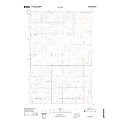
2020 Map of Schoonover
USGS Topo · Published 2020About this map
Schoonover occupies a central position within this dry-land agricultural landscape of eastern Washington, defined by a distinct grid of section lines and gravel access roads. The terrain is marked by significant topographical depressions, notably Rocky Coulee in the northeast and Farrier Coulee to the east, which create natural breaks in the otherwise geometric landscape. These coulees represent the glacial legacy of the region, where ancient floodwaters carved deep paths through the basalt.
Find a feature on this map
23 named features on this map. Tap any name to fly to it.
Don’t see what you’re looking for? This feature index may not catch every label — zoom into the map to look around manually.
Map Details
Editions of this 2020 Schoonover Map
This is the sole edition of this map. No revisions or reprints were ever made.
Other maps of this area

1953 · Ritzville
USGS Topo · 1:250,000

1959 · Ritzville
USGS Topo · 1:250,000

1965 · Ritzville
USGS Topo · 1:250,000

1967 · Reiman SW
USGS Topo · 1:24,000

1967 · Ritzville SW
USGS Topo · 1:24,000

1967 · Schoonover
USGS Topo · 1:24,000

1967 · Reiman
USGS Topo · 1:24,000

1967 · Ritzville NW
USGS Topo · 1:24,000
1967 · Reiman SE
USGS Topo · 1:24,000

1968 · Sylvan Lake
USGS Topo · 1:24,000