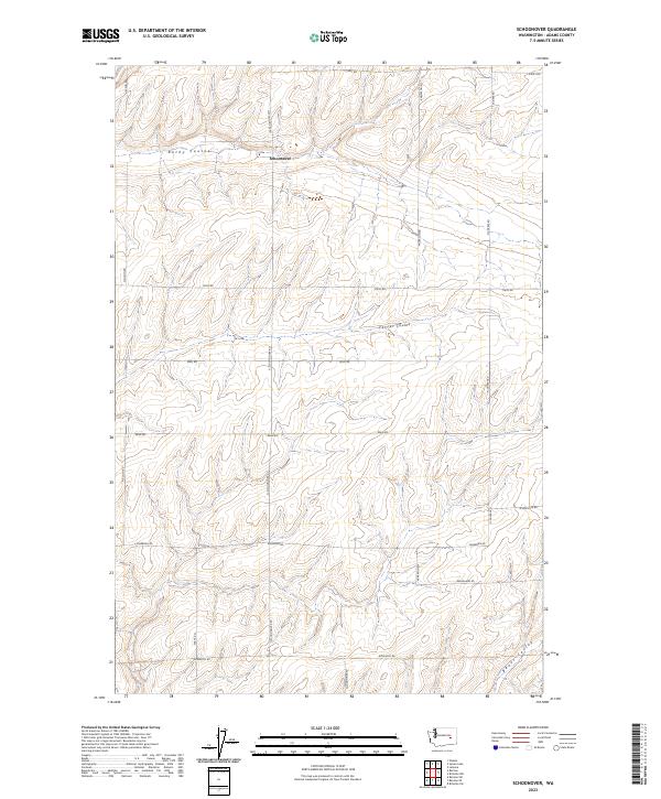
2023 Map of Schoonover
USGS Topo · Published 2023About this map
Schoonover sits in the high desert landscape of Adams County, where the terrain is defined by the significant drainage channels of Rocky Coulee, Farrier Coulee, and Bauer Coulee. This 2023 survey reveals a rural landscape partitioned into a grid of section lines and gravel routes that reflect the enduring agricultural character of the region. The map provides a contemporary view of local landmarks such as Tokio Rd, Rehn Rd, and Rosenoff Rd, which connect various farmsteads and rural properties. For those studying the geography of eastern Washington, the detailed topography illustrates how seasonal water flow has carved the land over time, creating the distinct coulee formations that still guide the placement of roads like Schoessler Rd and Neergaard Rd.
Find a feature on this map
27 named features on this map. Tap any name to fly to it.
Don’t see what you’re looking for? This feature index may not catch every label — zoom into the map to look around manually.
Map Details
Editions of this 2023 Schoonover Map
This is the sole edition of this map. No revisions or reprints were ever made.
Other maps of this area

1953 · Ritzville
USGS Topo · 1:250,000

1959 · Ritzville
USGS Topo · 1:250,000

1965 · Ritzville
USGS Topo · 1:250,000

1967 · Reiman SW
USGS Topo · 1:24,000

1967 · Ritzville SW
USGS Topo · 1:24,000

1967 · Schoonover
USGS Topo · 1:24,000

1967 · Reiman
USGS Topo · 1:24,000

1967 · Ritzville NW
USGS Topo · 1:24,000
1967 · Reiman SE
USGS Topo · 1:24,000

1968 · Sylvan Lake
USGS Topo · 1:24,000