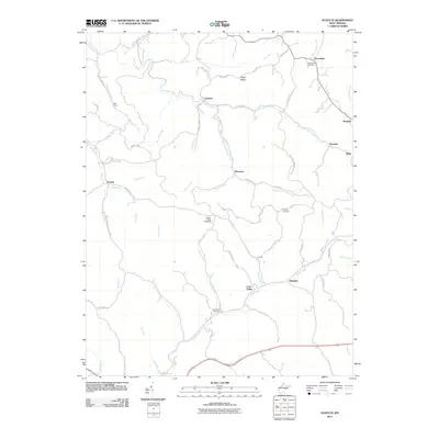
2011 Map of Schultz
USGS Topo · Published 2011About this map
Cloverdale Cemetery and Cloverdale anchor the northern reaches of this Pleasants County landscape, where deep hollows and narrow ridges dictate the pattern of rural West Virginia life. The topography is defined by the complex drainage of French Creek and the southern Goose Creek system, creating a patchwork of small upland communities like Calcutta, Schultz, and Lone Valley. For genealogists, the map preserves the locations of numerous family-linked landmarks, including the Ingram Ridge Cemetery and Layfields Cemetery. The layout of the road network, including Schultz Rd and King Ridge Rd, follows the natural contours of prominent high ground such as Hardy Hill Cunningham Ridge and Pigskin Ridge, illustrating how the terrain has historically restricted movement to the spines of the hills and the floors of the runs.
Find a feature on this map
70 named features on this map. Tap any name to fly to it.
Don’t see what you’re looking for? This feature index may not catch every label — zoom into the map to look around manually.
Map Details
Editions of this 2011 Schultz Map
This is the sole edition of this map. No revisions or reprints were ever made.
Other maps of this area

1904 · Marietta
USGS Topo · 1:62,500

1906 · Saint Marys
USGS Topo · 1:62,500

1906 · Elizabeth
USGS Topo · 1:62,500

1907 · Harrisville
USGS Topo · 1:62,500

1924 · St Marys
USGS Topo · 1:62,500

1924 · Harrisville
USGS Topo · 1:62,500

1924 · Marietta
USGS Topo · 1:62,500

1924 · Elizabeth
USGS Topo · 1:62,500

1926 · Elizabeth
USGS Topo · 1:62,500

1926 · Harrisville
USGS Topo · 1:62,500