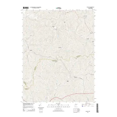
2014 Map of Schultz
USGS Topo · Published 2014About this map
Pleasants and the surrounding hill country sit at a crossroads of the Pleasants Co Ritchie Co border, where the landscape is defined by a dense network of creek valleys and ridges. This territory is marked by small settlements like Glendale, Calcutta, and Poynette, each connected by narrow county roads that follow the winding paths of French Cr and Goose Cr. Family and community history is anchored to high ground, with sites such as Ingram Ridge Cem and Cloverdale Cem overlooking the drainage basins of Layfields Run and Meadow Run. The southern edge of the map shows the corridor for Us-50, providing a modern transport contrast to the older ridge routes like Abby Ridge Rd and Pigskin Ridge. The convergence of Pleasants Co Wood Co and Ritchie County boundaries near the headwaters of Bull Creek highlights the complex political geography of this rural West Virginia region.
Find a feature on this map
93 named features on this map. Tap any name to fly to it.
Don’t see what you’re looking for? This feature index may not catch every label — zoom into the map to look around manually.
Map Details
Editions of this 2014 Schultz Map
This is the sole edition of this map. No revisions or reprints were ever made.
Other maps of this area

1904 · Marietta
USGS Topo · 1:62,500

1906 · Saint Marys
USGS Topo · 1:62,500

1906 · Elizabeth
USGS Topo · 1:62,500

1907 · Harrisville
USGS Topo · 1:62,500

1924 · St Marys
USGS Topo · 1:62,500

1924 · Harrisville
USGS Topo · 1:62,500

1924 · Marietta
USGS Topo · 1:62,500

1924 · Elizabeth
USGS Topo · 1:62,500

1926 · Elizabeth
USGS Topo · 1:62,500

1926 · Harrisville
USGS Topo · 1:62,500