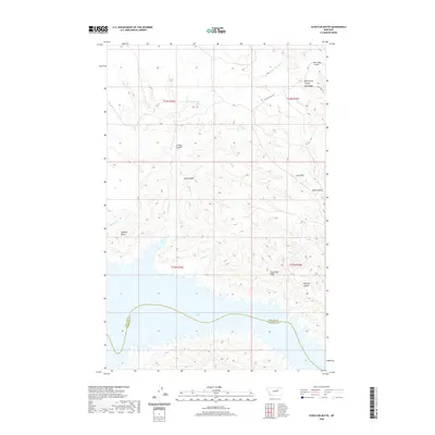
2020 Map of Schuyler Butte
USGS Topo · Published 2020About this map
Fort Peck Lake defines the southern reach of this landscape, where the waters meet the complex topography of central Montana. The terrain is characterized by a dense network of coulees and ridges, reflecting the erosion patterns typical of the region. Distinctive landmarks such as Schuyler Butte and Iron Stake Ridge provide vertical relief above the various drainages. The map records several family-named or descriptive terrain features including McCarty Coulee, Armstrong Coulee, and Cart Trail Coulee, which suggest the historic travel and ranching routes through the breaks. Waterways like Kill Woman Cr and Chippy Cr carve through the high ground of the Larb Hills and Blue Ridge, leading toward the massive reservoir. This area, spanning the Phillips County and Garfield County line, remains a largely undeveloped expanse of public and private rangeland accessed by routes like Coal Mine Hill Rd.
Find a feature on this map
20 named features on this map. Tap any name to fly to it.
Don’t see what you’re looking for? This feature index may not catch every label — zoom into the map to look around manually.
Map Details
Editions of this 2020 Schuyler Butte Map
This is the sole edition of this map. No revisions or reprints were ever made.
Other maps of this area

1954 · Jordan
USGS Topo · 1:250,000

1956 · Jordan
USGS Topo · 1:250,000

1958 · Jordan
USGS Topo · 1:250,000

1964 · Jordan
USGS Topo · 1:250,000

1965 · Coal Mine Hill
USGS Topo · 1:24,000

1965 · Lost Creek
USGS Topo · 1:24,000

1965 · Sun Prairie
USGS Topo · 1:24,000

1965 · Herman Point
USGS Topo · 1:24,000

1965 · Pine Grove School
USGS Topo · 1:24,000

1965 · Schuyler Butte
USGS Topo · 1:24,000