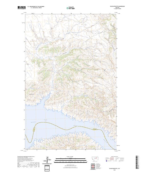
2024 Map of Schuyler Butte
USGS Topo · Published 2024About this map
Charles M Russell National Wildlife Refuge dominates this stretch of the Missouri River breaks, where the river meets the sprawling expanse of Fort Peck Lake. The landscape is defined by its dramatic drainage patterns, featuring a complex network of coulees such as Armstrong Coulee and La Plaz Coulee that cut through the high ground. The interaction between the plateau and the reservoir is visible along the Phillips Co and Garfield Co line, which follows the winding path of the submerged river channel.
Find a feature on this map
22 named features on this map. Tap any name to fly to it.
Don’t see what you’re looking for? This feature index may not catch every label — zoom into the map to look around manually.
Map Details
Editions of this 2024 Schuyler Butte Map
This is the sole edition of this map. No revisions or reprints were ever made.
Other maps of this area

1954 · Jordan
USGS Topo · 1:250,000

1956 · Jordan
USGS Topo · 1:250,000

1958 · Jordan
USGS Topo · 1:250,000

1964 · Jordan
USGS Topo · 1:250,000

1965 · Coal Mine Hill
USGS Topo · 1:24,000

1965 · Lost Creek
USGS Topo · 1:24,000

1965 · Sun Prairie
USGS Topo · 1:24,000

1965 · Herman Point
USGS Topo · 1:24,000

1965 · Pine Grove School
USGS Topo · 1:24,000

1965 · Schuyler Butte
USGS Topo · 1:24,000