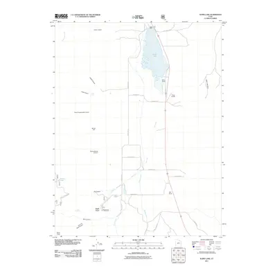
2011 Map of Scipio Lake
USGS Topo · Published 2011About this map
Scipio Lake and its northern Scipio Lake Dam dominate the upper portion of this Millard County landscape, where the water collects in Round Valley before feeding into Iule Creek. The terrain is defined by a series of deep drainages descending from the high ground to the west, including the uniquely named Hans Pumpernickle Canyon, Loafers Canyon, and Cutler Canyon. To the south, the settlement of Maple Grove serves as a gateway to the mountains, situated near the Maple Grove Campground and the transition into Rock Canyon. The map reveals a network of high-elevation water sources such as Libbs Spring, Cedar Spring, and Robins Lake, which support the local ecosystem alongside Willow Creek. Distinctive landforms like Dairy Knoll and Pharo Ridge provide clear navigation points across this desert valley and its adjacent foothills.
Find a feature on this map
38 named features on this map. Tap any name to fly to it.
Don’t see what you’re looking for? This feature index may not catch every label — zoom into the map to look around manually.
Map Details
Editions of this 2011 Scipio Lake Map
This is the sole edition of this map. No revisions or reprints were ever made.
Other maps of this area

1885 · Manti
USGS Topo · 1:250,000

1885 · Beaver
USGS Topo · 1:250,000

1885 · Sevier Desert
USGS Topo · 1:250,000

1885 · Fish Lake
USGS Topo · 1:250,000

1895 · Manti
USGS Topo · 1:250,000

1896 · Fish Lake
USGS Topo · 1:250,000

1953 · Richfield
USGS Topo · 1:250,000

1953 · Delta
USGS Topo · 1:250,000

1956 · Salina
USGS Topo · 1:250,000

1956 · Price
USGS Topo · 1:250,000