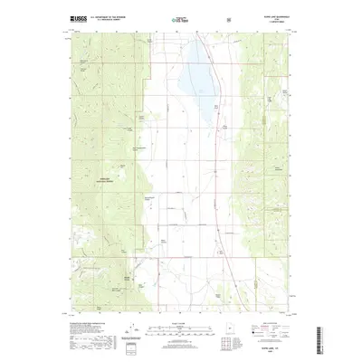
2020 Map of Scipio Lake
USGS Topo · Published 2020About this map
Scipio Lake and the high ridges of the Pahvant Range define this portion of central Utah where the boundaries of Millard, Sevier, and Sanpete counties converge. The landscape is characterized by a transition from the riparian corridors of Ivie Cr and Willow Cr to the steep elevations of Fishlake National Forest. The settlement at Maple Grove serves as a focal point near the mouth of Dry Canyon, positioned along the Richfield-Pioneer road network. The map reveals an intricate system of canyons and spurs, including the whimsically named Hans Pumpernickle Canyon and the high-altitude Coffee Peak - Scipio Pass. Topographic details trace the hydrology of the region from Robins Lake down through Pharo Canyon, illustrating how the valley floor at Round Valley is fed by seasonal drainages from the surrounding Valley Mountains.
Find a feature on this map
53 named features on this map. Tap any name to fly to it.
Don’t see what you’re looking for? This feature index may not catch every label — zoom into the map to look around manually.
Map Details
Editions of this 2020 Scipio Lake Map
This is the sole edition of this map. No revisions or reprints were ever made.
Other maps of this area

1885 · Manti
USGS Topo · 1:250,000

1885 · Beaver
USGS Topo · 1:250,000

1885 · Sevier Desert
USGS Topo · 1:250,000

1885 · Fish Lake
USGS Topo · 1:250,000

1895 · Manti
USGS Topo · 1:250,000

1896 · Fish Lake
USGS Topo · 1:250,000

1953 · Richfield
USGS Topo · 1:250,000

1953 · Delta
USGS Topo · 1:250,000

1956 · Salina
USGS Topo · 1:250,000

1956 · Price
USGS Topo · 1:250,000