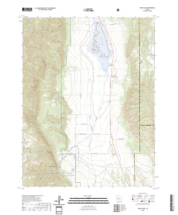
2023 Map of Scipio Lake
USGS Topo · Published 2023About this map
Scipio Lake dominates the central basin of Round Valley, where the waters of Round Valley Creek and Ivile Creek converge. To the west, the steep slopes of the Pahvant Range are carved by deep canyons such as Wild Goose Canyon and the evocatively named Hans Pumpernickle Canyon. This area includes portions of the Fishlake National Forest, where a network of trails like the Coffee Peak - Scipio Pass Trl and North Maple Grove Trl provide access to high-elevation features like Maple Grove and Pharo Ridge. The eastern side is bounded by the Valley Mountains, featuring landmarks like Dairy Knoll and South Valley. This landscape illustrates the complex geography of the Millard, Sanpete, and Sevier county borders as they meet in this high desert terrain.
Find a feature on this map
53 named features on this map. Tap any name to fly to it.
Don’t see what you’re looking for? This feature index may not catch every label — zoom into the map to look around manually.
Map Details
Editions of this 2023 Scipio Lake Map
This is the sole edition of this map. No revisions or reprints were ever made.
Other maps of this area

1885 · Manti
USGS Topo · 1:250,000

1885 · Beaver
USGS Topo · 1:250,000

1885 · Sevier Desert
USGS Topo · 1:250,000

1885 · Fish Lake
USGS Topo · 1:250,000

1895 · Manti
USGS Topo · 1:250,000

1896 · Fish Lake
USGS Topo · 1:250,000

1953 · Richfield
USGS Topo · 1:250,000

1953 · Delta
USGS Topo · 1:250,000

1956 · Salina
USGS Topo · 1:250,000

1956 · Price
USGS Topo · 1:250,000