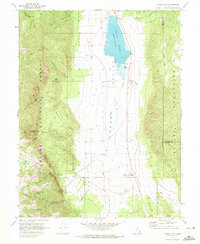
1969 Map of Scipio Lake
USGS Topo · Published 1972About this map
Scipio Lake and the broad expanse of Round Valley dominate this late 1960s survey of the Utah interior. The landscape is defined by the sharp contrast between the high, timbered ridges of the Fishlake National Forest to the west and the arid Valley Mountains to the east. Water management and livestock history are evident through features like the dam at Ivie Creek and the presence of several flowing wells and named springs. Genealogy and local history interest is concentrated in the northern valley where Graves are marked near the lake shore, and in the southern mountain recesses where the Maple Grove Campground sits. The map documents an intricate network of trails, including a dedicated pack trail system and various jeep trails navigating through Hans Pumpernickle Canyon and across Pharo Ridge.
Find a feature on this map
40 named features on this map. Tap any name to fly to it.
Don’t see what you’re looking for? This feature index may not catch every label — zoom into the map to look around manually.
Map Details
Editions of this 1969 Scipio Lake Map
This is the sole edition of this map. No revisions or reprints were ever made.
Other maps of this area

1885 · Manti
USGS Topo · 1:250,000

1885 · Beaver
USGS Topo · 1:250,000

1885 · Sevier Desert
USGS Topo · 1:250,000

1885 · Fish Lake
USGS Topo · 1:250,000

1895 · Manti
USGS Topo · 1:250,000

1896 · Fish Lake
USGS Topo · 1:250,000

1953 · Richfield
USGS Topo · 1:250,000

1953 · Delta
USGS Topo · 1:250,000

1956 · Salina
USGS Topo · 1:250,000

1956 · Price
USGS Topo · 1:250,000