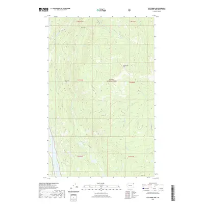
2020 Map of Scotchman Lake
USGS Topo · Published 2020About this map
The Colville National Forest dominates this northeastern Washington landscape, defined by a complex drainage system within the Selkirk Mountains. Elevated peaks like Molybdenite Mtn and Hanlon Mtn overlook a series of alpine and sub-alpine water bodies, including the significant reach of Sullivan Lake in the northwest and the smaller Deception Lake tucked into the high country. The terrain is marked by the prominent Dry Canyon Ridge and the southern Coyote Hill, which guide the flow of numerous named watercourses such as Harvey Creek and White-Man Cr. In the southwest corner, the Pend Oreille River briefly appears, anchoring the map's lowest elevations. The inclusion of the Pau Pac Tioga route suggests modern forest management and access within this protected wilderness area, while the clusters of Anderson Lake, Little Anderson Lake, and Caldwell Lake provide clear markers for recreational and environmental study.
Find a feature on this map
32 named features on this map. Tap any name to fly to it.
Don’t see what you’re looking for? This feature index may not catch every label — zoom into the map to look around manually.
Map Details
Editions of this 2020 Scotchman Lake Map
This is the sole edition of this map. No revisions or reprints were ever made.
Other maps of this area

1934 · Metaline
USGS Topo · 1:125,000

1942 · Metaline
USGS Topo · 1:125,000

1958 · Sandpoint
USGS Topo · 1:250,000

1963 · Sandpoint
USGS Topo · 1:250,000

1967 · Timber Mtn.
USGS Topo · 1:24,000

1967 · Ione
USGS Topo · 1:24,000

1967 · Scotchman Lake
USGS Topo · 1:24,000

1967 · Metaline
USGS Topo · 1:24,000

1967 · Metaline Falls
USGS Topo · 1:24,000

1967 · Monumental Mtn.
USGS Topo · 1:24,000