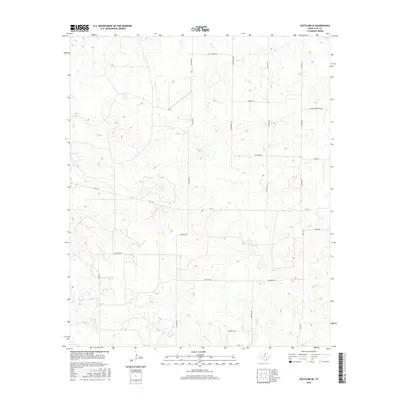
2016 Map of Scotland SE
USGS Topo · Published 2016About this map
Scaling Lake sits at the heart of this North Texas landscape, where the drainage of Deer Cr and Willow Cr carves a network of intermittent stream beds through Clay County. This 2016 survey illustrates a rural region defined by an expansive grid of family-named roads and ranch access routes, including Bill Gilmore Rd and Raymond Edwards Rd. The presence of Gasoline Aly south of Watson Rd hints at the local character and nomenclature of the area's rural transportation network. Property boundaries and land use are clearly delineated by the intersection of FM 174 with numerous local connectors like Scaling Rd and Wilson Rd, providing a clear record of the modern ranching and agricultural infrastructure in this part of the state.
Find a feature on this map
22 named features on this map. Tap any name to fly to it.
Don’t see what you’re looking for? This feature index may not catch every label — zoom into the map to look around manually.
Map Details
Editions of this 2016 Scotland SE Map
This is the sole edition of this map. No revisions or reprints were ever made.
Other maps of this area

1954 · Wichita Falls
USGS Topo · 1:250,000

1958 · Wichita Falls
USGS Topo · 1:250,000

1962 · Windthorst
USGS Topo · 1:24,000

1962 · Antelope Creek NE
USGS Topo · 1:24,000

1963 · Deer Creek
USGS Topo · 1:24,000

1963 · Scotland
USGS Topo · 1:24,000

1964 · Darnell Branch
USGS Topo · 1:24,000

1964 · Antelope
USGS Topo · 1:24,000

1964 · Scotland SE
USGS Topo · 1:24,000
1964 · Postoak
USGS Topo · 1:24,000