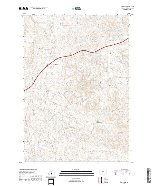
2021 Map of Scott Dam
USGS Topo · Published 2021About this map
Crenshaw Hill stands as a prominent high point in this corner of Campbell County, overlooking a landscape defined by seasonal water management and the rugged draws of the Powder River Basin. The terrain is etched with drainage networks including Kingsbury Cr and the various branches of the Dead Horse Creek system, such as N Prong Dead Horse Cr and Middle Prong Dead Horse Cr. Small-scale water storage is a defining characteristic of the local ranching economy, evidenced by several named catchments like Dogtown Reservoir, Alan Reservoir, and Lee Mankin Reservoir. Transportation is facilitated by a grid of rural routes and the more significant Buffalo Cut Across Rd, which provides vital access through the rolling topography of Johnson Draw and Upper Bushnell Draw.
Find a feature on this map
30 named features on this map. Tap any name to fly to it.
Don’t see what you’re looking for? This feature index may not catch every label — zoom into the map to look around manually.
Map Details
Editions of this 2021 Scott Dam Map
This is the sole edition of this map. No revisions or reprints were ever made.
Other maps of this area

1954 · Gillette
USGS Topo · 1:250,000

1955 · Gillette
USGS Topo · 1:250,000

1958 · Gillette
USGS Topo · 1:250,000

1962 · Gillette
USGS Topo · 1:250,000
1971 · Double Tanks
USGS Topo · 1:24,000
1971 · Scott Dam
USGS Topo · 1:24,000

1971 · Oriva
USGS Topo · 1:24,000
1971 · Pleasantdale
USGS Topo · 1:24,000
1971 · Four Bar J Ranch
USGS Topo · 1:24,000
1971 · Bogie Draw
USGS Topo · 1:24,000