1973 Map of Scotts Bluff 3 NE
USGS Topo · Published 1975About this map
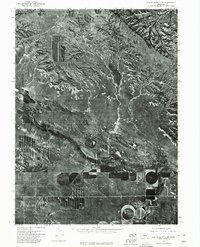
Pumpkin Creek meanders across the southern portion of this landscape, separating the rugged, dissected tablelands to the north from the intensely managed agricultural plots to the south. This 1973 orthophotoquad provides a high-resolution aerial view of the transition between the arid, eroded canyons of the Wildcat Hills region and the burgeoning irrigation systems of the valley floor. The contrast is sharp: the northern half of the map is dominated by natural drainage patterns and shadows cast by dramatic escarpments, while the south reveals the circular geometry of center-pivot irrigation systems and long, rectangular strip-cropping fields. These patterns reflect the mid-century evolution of farming practices in Banner County, where groundwater access transformed the arid plains into a productive agricultural zone along the creek's corridor.
Find a feature on this map
1 named feature on this map. Tap any name to fly to it.
Don’t see what you’re looking for? This feature index may not catch every label — zoom into the map to look around manually.
Map Details
Editions of this 1973 Scotts Bluff 3 NE Map
This is the sole edition of this map. No revisions or reprints were ever made.
Other maps of this area

1898 · Scotts Bluff
USGS Topo · 1:125,000

1954 · Scottsbluff
USGS Topo · 1:250,000

1958 · Scottsbluff
USGS Topo · 1:250,000

1960 · Stegall
USGS Topo · 1:24,000

1960 · Murray Lake
USGS Topo · 1:24,000

1963 · Scottsbluff South
USGS Topo · 1:24,000

1963 · Roubadeau Pass
USGS Topo · 1:24,000

1973 · Scotts Bluff 4 NW
USGS Topo · 1:24,000

1973 · Scotts Bluff 4 SW
USGS Topo · 1:24,000

1973 · Scotts Bluff 3 SE
USGS Topo · 1:24,000