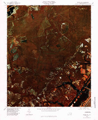
1980 Map of Scotts Hill
USGS Topo · Published 1985About this map
Scotts Hill and the coastal reaches of New Hanover County are captured in this color infrared orthophotograph, showcasing the landscape as it appeared in the fall of 1980. The image reveals a complex network of tidal waterways and drainage systems, with Pages Creek and Futch Creek carving into the terrain as they approach the Atlantic Ocean. Inland, the settlement of Murraysville and the agricultural blocks near Ogden contrast with the dense timber and wetlands surrounding Island Creek.
Find a feature on this map
11 named features on this map. Tap any name to fly to it.
Don’t see what you’re looking for? This feature index may not catch every label — zoom into the map to look around manually.
Map Details
Editions of this 1980 Scotts Hill Map
This is the sole edition of this map. No revisions or reprints were ever made.
Other maps of this area

1942 · Topsail
USGS Topo · 1:62,500

1942 · Wilmington
USGS Topo · 1:62,500

1947 · Rocky Point
USGS Topo · 1:62,500

1948 · Topsail
USGS Topo · 1:62,500

1948 · Wilmington
USGS Topo · 1:62,500

1953 · Beaufort
USGS Topo · 1:250,000

1954 · Beaufort
USGS Topo · 1:250,000

1970 · Hampstead
USGS Topo · 1:24,000
1970 · Wrightsville Beach
USGS Topo · 1:24,000

1970 · Topsail
USGS Topo · 1:24,000