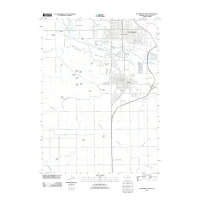
2011 Map of Scottsbluff South
USGS Topo · Published 2011About this map
The North Platte River carves a path between the growing urban centers of Scottsbluff and Gering, revealing a landscape defined by dramatic geological formations and intensive water management. The iconic landmark of Scotts Bluff dominates the central terrain, flanked by notable outcrops like Sentinel Rock, Eagle Rock, and Dome Rock. These formations hem in the historic route through Mitchell Pass, where the Old Oregon Trl once guided westward travelers.
Find a feature on this map
83 named features on this map. Tap any name to fly to it.
Don’t see what you’re looking for? This feature index may not catch every label — zoom into the map to look around manually.
Map Details
Editions of this 2011 Scottsbluff South Map
This is the sole edition of this map. No revisions or reprints were ever made.
Other maps of this area

1898 · Scotts Bluff
USGS Topo · 1:125,000

1954 · Scottsbluff
USGS Topo · 1:250,000

1958 · Scottsbluff
USGS Topo · 1:250,000

1963 · Scottsbluff South
USGS Topo · 1:24,000

1963 · Mitchell
USGS Topo · 1:24,000

1963 · Scottsbluff North
USGS Topo · 1:24,000

1963 · Roubadeau Pass
USGS Topo · 1:24,000

1965 · Minatare
USGS Topo · 1:24,000
1965 · Lake Alice
USGS Topo · 1:24,000

1973 · Scotts Bluff 4 NW
USGS Topo · 1:24,000