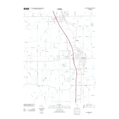
2013 Map of Scottsburg
USGS Topo · Published 2013About this map
Scottsburg serves as the central hub of this Scott County landscape, where the intersection of major transit corridors meets a complex network of local drainage ditches and creeks. To the south lies Vienna, while the smaller settlement of Leota is situated near Puppy Hollow in the southwestern quadrant. The geography is defined by the hydrologic patterns of the Muscatatuck River and its numerous tributaries, including Stucker Fork, Hutto Cr, and Iola Run, which feeds into Iola Lake. This era shows significant local infrastructure, from the Scottsburg Airport and Scottsburg Reservoir to numerous named small lakes such as Marshall King Lake, Hosea Lake, and Forrest Helton Lake. The map reveals a transition from the organized street grids of the towns to a rural landscape dissected by specialized water management features like Dens Ford Ditch, Plow Drain, and Ox Ditch.
Find a feature on this map
198 named features on this map. Tap any name to fly to it.
Don’t see what you’re looking for? This feature index may not catch every label — zoom into the map to look around manually.
Map Details
Editions of this 2013 Scottsburg Map
This is the sole edition of this map. No revisions or reprints were ever made.
Other maps of this area

1947 · Scottsburg
USGS Topo · 1:24,000

1949 · Henryville
USGS Topo · 1:24,000

1955 · South Boston
USGS Topo · 1:24,000

1956 · Otisco
USGS Topo · 1:24,000

1956 · Blocher
USGS Topo · 1:24,000

1956 · Deputy
USGS Topo · 1:24,000

1956 · Louisville
USGS Topo · 1:250,000

1958 · Little York
USGS Topo · 1:24,000

1959 · Tampico
USGS Topo · 1:24,000

1959 · Crothersville
USGS Topo · 1:24,000