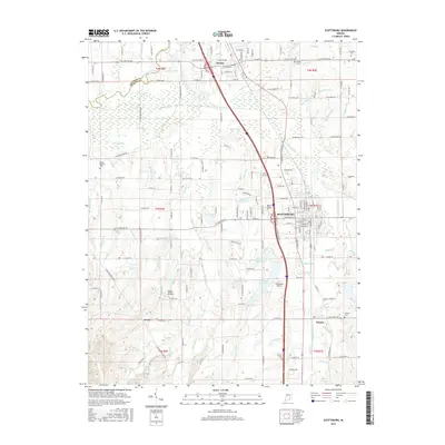
2016 Map of Scottsburg
USGS Topo · Published 2016About this map
The Scottsburg and Austin corridor in southern Indiana is defined here by the parallel lines of the Louisville & Indiana RR and Interstate 65. This infrastructure connects the larger settlements while the surrounding landscape remains largely agricultural, bisected by a complex network of waterways including the Muscatatuck River and its various man-made channels like Stink Ditch and Ox Ditch. The presence of numerous family and community cemeteries, such as Spurgeon Cem and Cravens Cem, offers significant detail for local genealogists.
Find a feature on this map
123 named features on this map. Tap any name to fly to it.
Don’t see what you’re looking for? This feature index may not catch every label — zoom into the map to look around manually.
Map Details
Editions of this 2016 Scottsburg Map
This is the sole edition of this map. No revisions or reprints were ever made.
Other maps of this area

1947 · Scottsburg
USGS Topo · 1:24,000

1949 · Henryville
USGS Topo · 1:24,000

1955 · South Boston
USGS Topo · 1:24,000

1956 · Otisco
USGS Topo · 1:24,000

1956 · Blocher
USGS Topo · 1:24,000

1956 · Deputy
USGS Topo · 1:24,000

1956 · Louisville
USGS Topo · 1:250,000

1958 · Little York
USGS Topo · 1:24,000

1959 · Tampico
USGS Topo · 1:24,000

1959 · Crothersville
USGS Topo · 1:24,000