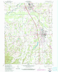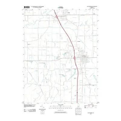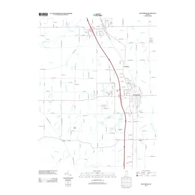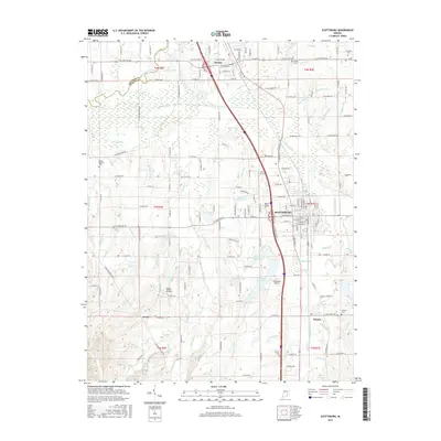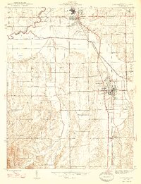
1947 Map of Scottsburg
USGS Topo · Published 1947About this map
The Pennsylvania Railroad railroad corridor defines the development of this southern Indiana landscape, connecting the primary settlements of Scottsburg, Austin, and Vienna. This mid-century survey reveals a rural society structured around local community hubs, where small outposts like Leota and Carlisle sit alongside landmarks of local governance and faith, including the County Farm and Mt Zion Ch. The complex drainage system of the Muscatatuck River and its tributaries, such as Stucker Fork and Big Ox Creek, dominates the western and northern terrain, illustrating the historical reliance on these natural waterways and ditches for land management. Genealogists will find particular value in the placement of the Spurgeon Cem and several churches like Zion Ch and Old Ox Ch that served the outlying farming families of the Finley and Vienna townships during this era.
Find a feature on this map
34 named features on this map. Tap any name to fly to it.
Don’t see what you’re looking for? This feature index may not catch every label — zoom into the map to look around manually.
Map Details
Editions of this 1947 Scottsburg Map
2 editions found
Historical Maps of Vienna Through Time
7 maps found