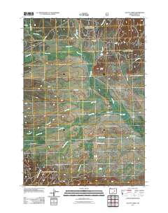
2011 Map of Scotty Creek
USGS Topo · Published 2011About this map
Bear Valley defines the central landscape of this Grant County region, serving as a high-altitude drainage basin for a complex network of waterways. The Silvies River meanders across the northern and eastern reaches, joined by numerous tributaries including Wymer Creek, Jack Creek, and Scotty Creek. This area is characterized by large agricultural holdings and remote outposts, such as the Ninety-Six Ranch and Holliday Ranch, reflecting the enduring ranching tradition of eastern Oregon. Infrastructure is sparse, anchored by County Hwy 49 and County Hwy 64, alongside specialized aviation features like Cerny Airport and a remote Emergency Airstrip. From the elevations of Windy Point to the seasonal water sources at Willow Springs, the map reveals a working landscape shaped by cattle movement and high-desert hydrology.
Find a feature on this map
31 named features on this map. Tap any name to fly to it.
Don’t see what you’re looking for? This feature index may not catch every label — zoom into the map to look around manually.
Map Details
Editions of this 2011 Scotty Creek Map
This is the sole edition of this map. No revisions or reprints were ever made.
Other maps of this area

1940 · Mount Vernon
USGS Topo · 1:62,500

1940 · John Day
USGS Topo · 1:62,500

1943 · John Day
USGS Topo · 1:62,500

1943 · Mount Vernon
USGS Topo · 1:62,500

1955 · Canyon City
USGS Topo · 1:250,000

1959 · Canyon City
USGS Topo · 1:250,000

1961 · Logdell
USGS Topo · 1:62,500

1961 · Seneca
USGS Topo · 1:62,500

1972 · Canyon Mtn
USGS Topo · 1:24,000
1972 · Mc Clellan Mtn
USGS Topo · 1:24,000