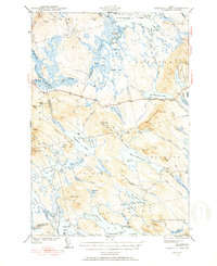
1941 Map of Scraggly Lake
USGS Topo · Published 1941About this map
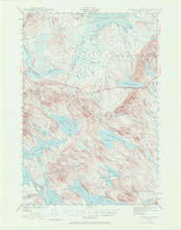
Musquash Mountain dominates the center of this 1941 landscape, topped by a Fire Tower that overlooks a complex network of glacial lakes and bogs. Located along the boundary of Penobscot and Washington counties, the area is defined by massive water bodies including Baskahegan Lake and West Musquash Lake. The terrain is characterized by long, north-south oriented ridges like Pleasant Lake Ridge and Trout Lake Ridge, which reveal the deep glacial history of this region.
Find a feature on this map
77 named features on this map. Tap any name to fly to it.
Don’t see what you’re looking for? This feature index may not catch every label — zoom into the map to look around manually.
Map Details
Editions of this 1941 Scraggly Lake Map
6 editions found
Other maps of this area

1931 · Springfield
USGS Topo · 1:48,000

1932 · Nicatous Lake
USGS Topo · 1:48,000

1934 · Nicatous Lake
USGS Topo · 1:62,500

1934 · Springfield
USGS Topo · 1:62,500

1940 · Danforth
USGS Topo · 1:62,500

1940 · Waite
USGS Topo · 1:62,500

1940 · Forest
USGS Topo · 1:62,500

1941 · Danforth
USGS Topo · 1:62,500

1941 · Scraggly Lake
USGS Topo · 1:62,500

1941 · Big Lake
USGS Topo · 1:62,500