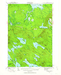
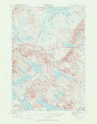
1941 Map of Scraggly Lake
USGS Topo · Published 1963About this map
Baskahegan Lake and the interconnected waters of eastern Maine define this landscape, surveyed by F. F. Blankenbaker and his team in the early 1940s. The region is a dense network of glacial lakes, bogs, and prominent peaks like Musquash Mountain, which is topped by a Fire Tower. The transition between Penobscot and Washington counties is clearly marked as it traverses Pleasant Lake Ridge and the shores of Shaw Lake. This map captures a largely undeveloped interior before later mid-century changes, characterized by difficult-to-access bogs such as Crabtree Bog and Caribou Bog. Localized terrain features like Black Cat Rips and Lake Rips along the streams suggest a landscape shaped by active waterways and timber potential, while family-named landmarks like Loring Hill and Dill Hill provide essential reference points for genealogists tracking early land use in the unorganized townships of T 8 R 3 and T 7 R 2.
Find a feature on this map
91 named features on this map. Tap any name to fly to it.
Don’t see what you’re looking for? This feature index may not catch every label — zoom into the map to look around manually.
Map Details
Editions of this 1941 Scraggly Lake Map
6 editions found
Other maps of this area

1931 · Springfield
USGS Topo · 1:48,000

1932 · Nicatous Lake
USGS Topo · 1:48,000

1934 · Nicatous Lake
USGS Topo · 1:62,500

1934 · Springfield
USGS Topo · 1:62,500

1940 · Danforth
USGS Topo · 1:62,500

1940 · Waite
USGS Topo · 1:62,500

1940 · Forest
USGS Topo · 1:62,500

1941 · Danforth
USGS Topo · 1:62,500

1941 · Scraggly Lake
USGS Topo · 1:62,500

1941 · Big Lake
USGS Topo · 1:62,500