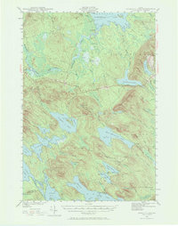
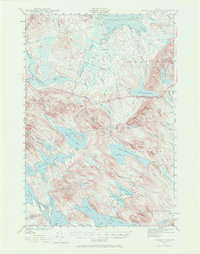
1941 Map of Scraggly Lake
USGS Topo · Published 1972About this map
Musquash Mountain dominates this portion of Washington County, its heights capped by a prominent Fire Tower overlooking a complex network of waterways and wetlands. Surveyed in the early 1940s, the landscape is defined by the expansive Baskahegan Lake and the winding course of Baskahegan Stream, which flows through numerous marshy depressions including Crabtree Bog and Caribou Bog. The mapping reveals a remote timber and water-shed territory where topographic features like Pleasant Ridge and Horse Hill separate the various drainages of the East Musquash Lake and its surrounding tributaries. Human imprints are sparse, represented by logging-related routes such as Lathrop Road and named peaks like Tracy Mtn and Bowers Mtn, reflecting the area's history as a hub for inland Maine's forestry and freshwater fishing industries.
Find a feature on this map
81 named features on this map. Tap any name to fly to it.
Don’t see what you’re looking for? This feature index may not catch every label — zoom into the map to look around manually.
Map Details
Editions of this 1941 Scraggly Lake Map
6 editions found
Other maps of this area

1931 · Springfield
USGS Topo · 1:48,000

1932 · Nicatous Lake
USGS Topo · 1:48,000

1934 · Nicatous Lake
USGS Topo · 1:62,500

1934 · Springfield
USGS Topo · 1:62,500

1940 · Danforth
USGS Topo · 1:62,500

1940 · Waite
USGS Topo · 1:62,500

1940 · Forest
USGS Topo · 1:62,500

1941 · Danforth
USGS Topo · 1:62,500

1941 · Scraggly Lake
USGS Topo · 1:62,500

1941 · Big Lake
USGS Topo · 1:62,500