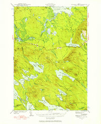
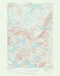
1941 Map of Scraggly Lake
USGS Topo · Published 1957About this map
Musquash Mountain dominates the center of this 1941 survey, crowned by a Fire Tower that overlooks a complex network of glacial lakes and wetlands in eastern Maine. The landscape is defined by the transition between high ridges like Stetson Mtn and Dill Hill and the sprawling waters of Baskahegan Lake and East Musquash Lake. This area, divided into unincorporated townships like Topsfield and Talmadge, reflects a region shaped by the logging industry, where naming conventions like Black Cat Rips and Crabtree Bog point to the local character of the waterways. Historically, these lakes served as vital transport corridors before the expansion of modern road systems, and the map captures the early trail and unimproved road network used by foresters and early sportsmen in the northern Maine woods.
Find a feature on this map
97 named features on this map. Tap any name to fly to it.
Don’t see what you’re looking for? This feature index may not catch every label — zoom into the map to look around manually.
Map Details
Editions of this 1941 Scraggly Lake Map
6 editions found
Other maps of this area

1931 · Springfield
USGS Topo · 1:48,000

1932 · Nicatous Lake
USGS Topo · 1:48,000

1934 · Nicatous Lake
USGS Topo · 1:62,500

1934 · Springfield
USGS Topo · 1:62,500

1940 · Danforth
USGS Topo · 1:62,500

1940 · Waite
USGS Topo · 1:62,500

1940 · Forest
USGS Topo · 1:62,500

1941 · Danforth
USGS Topo · 1:62,500

1941 · Scraggly Lake
USGS Topo · 1:62,500

1941 · Big Lake
USGS Topo · 1:62,500