
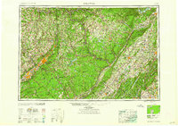
1959 Map of Scranton
USGS Topo · Published 1959About this map
The Scranton and Wilkes-Barre industrial corridor anchors this mid-century topographic perspective, revealing the dense settlement patterns of the Lackawanna and Wyoming Valleys. Coal-era rail infrastructure remains prominent, with the Delaware Lackawanna and Western RR and Erie Railroad threading through the Moosic Mountains. To the east, the map captures a landscape of massive reservoirs serving the New York metropolitan area, including the Ashokan Reservoir and Neversink Reservoir, highlighting the era's significant hydraulic engineering. From the peaks of the Catskill Mountains to the recreational expanse of Lake Wallenpaupack, the sheet documents the transition from urban centers to the protected wildlands of Harriman State Park and Catskill Park. This survey reflects a pivotal moment just as the New York State Thruway and Garden State Parkway began to redefine regional travel.
Find a feature on this map
200 named features on this map. Tap any name to fly to it.
Don’t see what you’re looking for? This feature index may not catch every label — zoom into the map to look around manually.
Map Details
Editions of this 1959 Scranton Map
2 editions found
Other maps of this area

1888 · Franklin
USGS Topo · 1:62,500

1888 · Morristown
USGS Topo · 1:62,500

1888 · Hackettstown
USGS Topo · 1:62,500

1888 · Lake Hopatcong
USGS Topo · 1:62,500

1888 · Paterson
USGS Topo · 1:62,500

1889 · Scranton
USGS Topo · 1:62,500

1889 · Hazleton
USGS Topo · 1:62,500

1891 · Greenwood Lake
USGS Topo · 1:62,500

1891 · Ramapo
USGS Topo · 1:62,500

1891 · Wilkesbarre
USGS Topo · 1:62,500