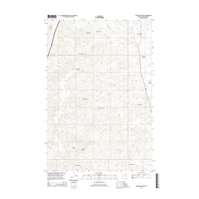
2014 Map of Scraper Coulee
USGS Topo · Published 2014About this map
Scraper Coulee and its neighboring drainages define this portion of Treasure County, where the high plains of Montana are carved by a dense network of coulees and springs. The landscape is characterized by intermittent water sources like Sandrock Spring and Garverich Spring, which have long been vital for cattle ranching in this arid region. Higher elevations are accessed by local routes such as Gumbo Hill Rd and Cemetery Rd, the latter suggesting local historical significance near the northern boundary. The drainage pattern is complex, with water moving through Wales Coulee and Miller Coulee toward larger features like Sarpy Cr and Box Elder Cr. This 2014 survey records the township and range divisions, such as t5n r36e, reflecting the enduring Public Land Survey System that governs the spatial organization of Montana’s ranch lands.
Find a feature on this map
19 named features on this map. Tap any name to fly to it.
Don’t see what you’re looking for? This feature index may not catch every label — zoom into the map to look around manually.
Map Details
Editions of this 2014 Scraper Coulee Map
This is the sole edition of this map. No revisions or reprints were ever made.
Other maps of this area

1954 · Forsyth
USGS Topo · 1:250,000

1957 · Forsyth
USGS Topo · 1:250,000

1958 · Forsyth
USGS Topo · 1:250,000

1960 · Hysham
USGS Topo · 1:24,000

1960 · Myers
USGS Topo · 1:24,000

1960 · Sanders
USGS Topo · 1:24,000

1960 · Eldering Ranch
USGS Topo · 1:24,000

1960 · Hope Ranch
USGS Topo · 1:24,000
1972 · Minnehaha Creek North
USGS Topo · 1:24,000
1972 · South Bear Creek
USGS Topo · 1:24,000