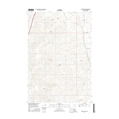
2017 Map of Scraper Coulee
USGS Topo · Published 2017About this map
Sandrock Spring and Garverich Spring anchor the drainages in this ranching landscape of Treasure County. The terrain is defined by a series of deep coulees including Wales Coulee, Miller Coulee, and the eponymous Scraper Coulee, which serve as natural catchments for seasonal runoff feeding into Sarpy Cr and Box Elder Cr.
Find a feature on this map
21 named features on this map. Tap any name to fly to it.
Don’t see what you’re looking for? This feature index may not catch every label — zoom into the map to look around manually.
Map Details
Editions of this 2017 Scraper Coulee Map
This is the sole edition of this map. No revisions or reprints were ever made.
Other maps of this area

1954 · Forsyth
USGS Topo · 1:250,000

1957 · Forsyth
USGS Topo · 1:250,000

1958 · Forsyth
USGS Topo · 1:250,000

1960 · Hysham
USGS Topo · 1:24,000

1960 · Myers
USGS Topo · 1:24,000

1960 · Sanders
USGS Topo · 1:24,000

1960 · Eldering Ranch
USGS Topo · 1:24,000

1960 · Hope Ranch
USGS Topo · 1:24,000
1972 · Minnehaha Creek North
USGS Topo · 1:24,000
1972 · South Bear Creek
USGS Topo · 1:24,000