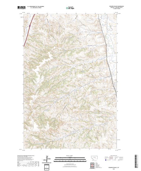
2024 Map of Scraper Coulee
USGS Topo · Published 2024About this map
Sarpy Creek flows through this corner of Treasure County, defining a landscape marked by the complex drainage systems of the Montana plains. The topography is dominated by a series of deep coulees, including the namesake Scraper Coulee, Whitcomb Coulee, and Miller Coulee, which create a highly textured terrain of ridges and draws. These features provide essential context for understanding the historic movement of people and livestock through the region, where water sources like Sandrock Spring and Cedar Creek Spring were vital points of interest for early settlers and ranchers. Infrastructure is limited to a sparse network of roads, such as Sarpy Rd and Gumbo Hill Rd, which trace the more accessible paths through the upland draws. The map illustrates a contemporary view of these traditional ranching lands, where the natural watercourses of West Corral Creek and Cedar Coulee continue to shape the character of the rural landscape.
Find a feature on this map
18 named features on this map. Tap any name to fly to it.
Don’t see what you’re looking for? This feature index may not catch every label — zoom into the map to look around manually.
Map Details
Editions of this 2024 Scraper Coulee Map
This is the sole edition of this map. No revisions or reprints were ever made.
Other maps of this area

1954 · Forsyth
USGS Topo · 1:250,000

1957 · Forsyth
USGS Topo · 1:250,000

1958 · Forsyth
USGS Topo · 1:250,000

1960 · Hysham
USGS Topo · 1:24,000

1960 · Myers
USGS Topo · 1:24,000

1960 · Sanders
USGS Topo · 1:24,000

1960 · Eldering Ranch
USGS Topo · 1:24,000

1960 · Hope Ranch
USGS Topo · 1:24,000
1972 · Minnehaha Creek North
USGS Topo · 1:24,000
1972 · South Bear Creek
USGS Topo · 1:24,000