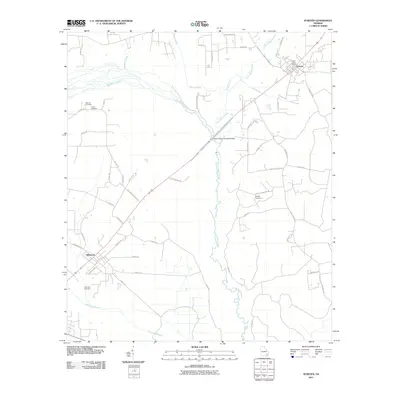
2011 Map of Screven
USGS Topo · Published 2011About this map
Screven and Offerman anchor this Wayne County landscape, where the local economy and geography are defined by a network of waterways and rural corridors. The Little Satilla River and its primary tributary, Little Satilla Creek, dominate the central drainage, while Big Satilla Creek flows through the western portion of the quadrangle. The infrastructure reflects a long-standing agricultural and timber heritage, seen in routes like Stage Coach Rd and Sawmill Rd, which connect scattered family homesteads and local landmarks.
Find a feature on this map
53 named features on this map. Tap any name to fly to it.
Don’t see what you’re looking for? This feature index may not catch every label — zoom into the map to look around manually.
Map Details
Editions of this 2011 Screven Map
This is the sole edition of this map. No revisions or reprints were ever made.
Other maps of this area

1918 · Jesup
USGS Topo · 1:62,500

1918 · Hortense
USGS Topo · 1:62,500

1943 · Jesup
USGS Topo · 1:62,500

1944 · Hortense
USGS Topo · 1:62,500

1946 · Brunswick
USGS Topo · 1:250,000

1948 · Brunswick
USGS Topo · 1:250,000

1953 · Waycross
USGS Topo · 1:250,000

1956 · Brunswick
USGS Topo · 1:250,000

1958 · Waycross
USGS Topo · 1:250,000

1961 · Brunswick
USGS Topo · 1:250,000