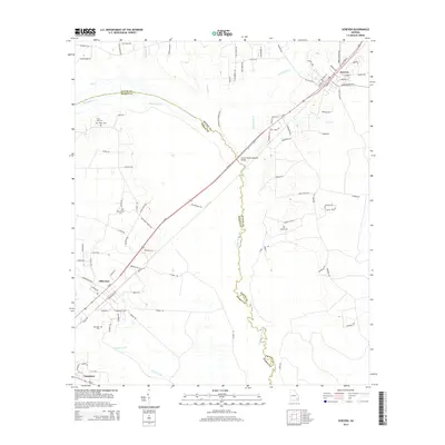
2014 Map of Screven
USGS Topo · Published 2014About this map
Screven and Offerman anchor this portion of the Georgia coastal plain, where the meandering course of the Little Satilla River forms a natural boundary between Wayne and Pierce counties. The landscape is defined by its complex hydrology, with numerous tributaries like Big Satilla Cr, Tiger Cr, and Sixty Foot Br threading through the low-lying terrain. The road network connects small rural communities via routes like Odum Screven Rd and Broadhurst Rd W, while the Doctor McKee Hargrett Bridge provides a vital crossing over the river swamp. Local history is preserved in several family and community burial grounds, including Moody Cem and Foster Cem, which are tucked away from the main thoroughfares. The settlement pattern follows the high ground between wetlands, showing how the geography of these river basins has historically dictated the placement of homes and transit corridors in this region.
Find a feature on this map
91 named features on this map. Tap any name to fly to it.
Don’t see what you’re looking for? This feature index may not catch every label — zoom into the map to look around manually.
Map Details
Editions of this 2014 Screven Map
This is the sole edition of this map. No revisions or reprints were ever made.
Other maps of this area

1918 · Jesup
USGS Topo · 1:62,500

1918 · Hortense
USGS Topo · 1:62,500

1943 · Jesup
USGS Topo · 1:62,500

1944 · Hortense
USGS Topo · 1:62,500

1946 · Brunswick
USGS Topo · 1:250,000

1948 · Brunswick
USGS Topo · 1:250,000

1953 · Waycross
USGS Topo · 1:250,000

1956 · Brunswick
USGS Topo · 1:250,000

1958 · Waycross
USGS Topo · 1:250,000

1961 · Brunswick
USGS Topo · 1:250,000