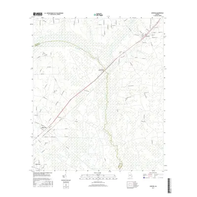
2017 Map of Screven
USGS Topo · Published 2017About this map
Screven and Offerman anchor this portion of Wayne and Pierce counties, where the Little Satilla River and its meandering tributaries dominate the landscape. The geography is defined by a series of bays and swamps, such as Zeco Bay and Mud Swamp, illustrating the low-lying, wetland-rich character of this Southeast Georgia region. The CSX railroad corridor serves as a primary axis, running parallel to the highway through the heart of these timber and rail-dependent communities. Genealogists will find a high concentration of local burial grounds, including Clay Hill Cem, Foster Cem, New Home Cem, and the Offerman Cem. A significant local landmark, the Doctor McKee Hargrett Bridge, spans the wetlands between the settlements, while rural routes like Plantation Rd and Nine Run Rd connect the outlying farmsteads and wooded tracts.
Find a feature on this map
98 named features on this map. Tap any name to fly to it.
Don’t see what you’re looking for? This feature index may not catch every label — zoom into the map to look around manually.
Map Details
Editions of this 2017 Screven Map
This is the sole edition of this map. No revisions or reprints were ever made.
Other maps of this area

1918 · Jesup
USGS Topo · 1:62,500

1918 · Hortense
USGS Topo · 1:62,500

1943 · Jesup
USGS Topo · 1:62,500

1944 · Hortense
USGS Topo · 1:62,500

1946 · Brunswick
USGS Topo · 1:250,000

1948 · Brunswick
USGS Topo · 1:250,000

1953 · Waycross
USGS Topo · 1:250,000

1956 · Brunswick
USGS Topo · 1:250,000

1958 · Waycross
USGS Topo · 1:250,000

1961 · Brunswick
USGS Topo · 1:250,000