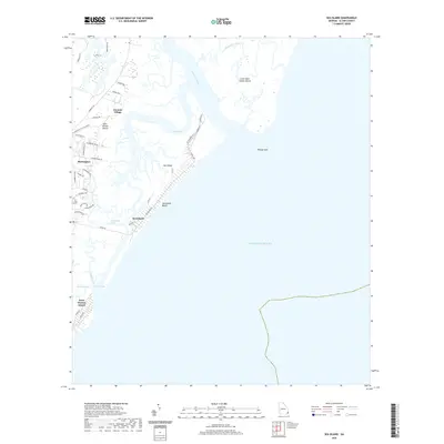
2020 Map of Sea Island
USGS Topo · Published 2020About this map
Sea Island and its famous coastal geography are documented in this recent survey of Glynn County's barrier islands. The intricate network of tidal waterways, including the Hampton River, Village Creek, and Blackbank River, carves through the marshlands and separates the major landmasses of Saint Simons Island and Little Saint Simons Island. The map records the contemporary footprint of local communities such as Harrington and German Village, along with specialized terrain like Pelican Spit and Bloody Marsh. The coastal edge is defined by the expansive Sea Island Beach facing the Atlantic Ocean, while Goulds Inlet and Postell Creek provide critical drainage points for the island's interior wetlands. This modern topographic record reflects the balance between developed resort areas and the preservation of the region's diverse estuarine environment.
Find a feature on this map
47 named features on this map. Tap any name to fly to it.
Don’t see what you’re looking for? This feature index may not catch every label — zoom into the map to look around manually.
Map Details
Editions of this 2020 Sea Island Map
This is the sole edition of this map. No revisions or reprints were ever made.
Other maps of this area

1920 · Cabretta Island
USGS Topo · 1:62,500

1921 · Darien
USGS Topo · 1:62,500

1944 · Cabretta Island
USGS Topo · 1:62,500

1945 · Brunswick
USGS Topo · 1:62,500

1946 · Brunswick
USGS Topo · 1:250,000

1948 · Brunswick
USGS Topo · 1:250,000

1954 · Altamaha Sound
USGS Topo · 1:24,000
1955 · Sea Island
USGS Topo · 1:24,000
1956 · Brunswick East
USGS Topo · 1:24,000
1956 · Darien
USGS Topo · 1:24,000