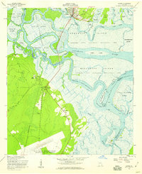
1956 Map of Darien
USGS Topo · Published 1959About this map
Darien stands as the historic gateway to a complex delta where the Altamaha River breaks into a network of tidewater channels and sediment-rich islands. This mid-century survey records a landscape shaped by both colonial history and modern conservation, featuring the Old Fort King George landmark and the Santo Domingo Mission Ruins. The vast Altamaha State Waterfowl Management Area dominates the marshes of Butler Island, Champney Island, and Generals Island, where former rice plantation lands transitioned into protected habitats. On the mainland, the Atlantic Coastal Highway links rural settlements like Evelyn, Broadfield, and New Hope. Significant genealogical sites are noted, including the Freedman and Petersville cemeteries. To the south, the massive footprint of the U S Naval Reservation Glynco Naval Air Station marks the Cold War military presence in Glynn County.
Find a feature on this map
67 named features on this map. Tap any name to fly to it.
Don’t see what you’re looking for? This feature index may not catch every label — zoom into the map to look around manually.
Map Details
Editions of this 1956 Darien Map
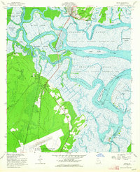
2 editions found
Other maps of this area

1918 · Everett City
USGS Topo · 1:62,500

1918 · Bladen
USGS Topo · 1:62,500

1920 · Everett City
USGS Topo · 1:62,500

1921 · Darien
USGS Topo · 1:62,500

1939 · Bladen
USGS Topo · 1:62,500

1944 · Everett City
USGS Topo · 1:62,500

1945 · Brunswick
USGS Topo · 1:62,500

1946 · Brunswick
USGS Topo · 1:250,000

1948 · Brunswick
USGS Topo · 1:250,000

1954 · Altamaha Sound
USGS Topo · 1:24,000