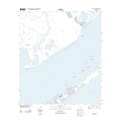
2013 Map of Sea Isle
USGS Topo · Published 2013About this map
Galveston Island stretches across the southern portion of this survey, serving as the base for several established coastal communities. Developments like Sea Isle, Terramar Beach, and Bay Harbor are characterized by canal-front residential layouts and a dense network of local streets, including San Luis Pass Rd and Kennedy Dr. The map illustrates the specialized infrastructure of this barrier island landscape, featuring the Marina at Sea Isle and the residential fingers reaching into West Bay.
Find a feature on this map
67 named features on this map. Tap any name to fly to it.
Don’t see what you’re looking for? This feature index may not catch every label — zoom into the map to look around manually.
Map Details
Editions of this 2013 Sea Isle Map
This is the sole edition of this map. No revisions or reprints were ever made.
Other maps of this area

1929 · Karankawa Lake
USGS Topo · 1:24,000

1929 · Hitchcock
USGS Topo · 1:24,000

1929 · Virginia Point
USGS Topo · 1:24,000

1931 · Lake Como
USGS Topo · 1:24,000

1932 · Hitchcock
USGS Topo · 1:31,680

1932 · Mustang Bayou
USGS Topo · 1:31,680

1932 · Virginia Point
USGS Topo · 1:31,680

1933 · Karankawa Lake
USGS Topo · 1:31,680

1933 · San Luis Pass
USGS Topo · 1:31,680
1933 · Lake Como
USGS Topo · 1:31,680