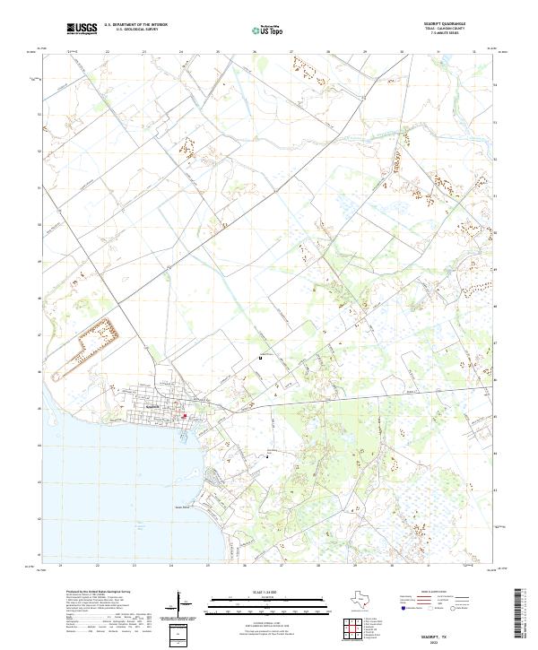
2022 Map of Seadrift
USGS Topo · Published 2022About this map
San Antonio Bay defines the southwestern edge of this coastal landscape, where the settlement of Seadrift sits at the interface of land and water. The town's grid is clearly delineated, extending from waterfront avenues like Broadway Ave and Houston Ave back toward the inland prairie. The surrounding rural area is a network of drainage ways including West Coloma Creek and E Coloma Cr, which flow toward the bay. For local historians and genealogists, the map identifies specific burial sites such as Seadrift Cem and the Stiernberg Cem, both situated north and east of the primary town center. The coastal profile is marked by the distinct protrusion of Swan Point, while the road network, including the Old Seadrift Hwy and various family-named routes like Fisher Smith Rd, reflects the area's agricultural and transit history in Calhoun County.
Find a feature on this map
56 named features on this map. Tap any name to fly to it.
Don’t see what you’re looking for? This feature index may not catch every label — zoom into the map to look around manually.
Map Details
Editions of this 2022 Seadrift Map
This is the sole edition of this map. No revisions or reprints were ever made.
Other maps of this area

1952 · Port Lavaca East
USGS Topo · 1:24,000

1952 · Mosquito Point
USGS Topo · 1:24,000

1952 · Long Island
USGS Topo · 1:24,000

1952 · Tivoli SE
USGS Topo · 1:24,000

1952 · Seadrift NE
USGS Topo · 1:24,000

1952 · Austwell
USGS Topo · 1:24,000

1952 · Seadrift
USGS Topo · 1:24,000

1952 · Port Lavaca West
USGS Topo · 1:24,000

1952 · Green Lake
USGS Topo · 1:24,000

1953 · Beeville
USGS Topo · 1:250,000