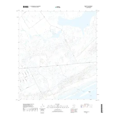
2019 Map of Seadrift NE
USGS Topo · Published 2019About this map
Espiritu Santo Bay and Shoalwater Bay dominate the coastal margins of this landscape, separated by the narrow landform of Dewberry Island. The area is defined by its low-lying wetlands and the critical transit corridor of the Intracoastal Waterway, which cuts through the southern reaches. Inland, the terrain is shaped by Coloma Creek as it meanders toward the bays. A network of rural roads, including FM 1289 and Adams St, connects scattered homesteads and property lines. Family-named routes such as Wittnebert Rd, Morales Rd, and Carabajal Rd suggest the local heritage and landownership patterns of this part of Calhoun County. The map provides a detailed view of the drainage and marshy environment characteristic of the Texas Gulf Coast, where water and land constantly intersect.
Find a feature on this map
21 named features on this map. Tap any name to fly to it.
Don’t see what you’re looking for? This feature index may not catch every label — zoom into the map to look around manually.
Map Details
Editions of this 2019 Seadrift NE Map
This is the sole edition of this map. No revisions or reprints were ever made.
Other maps of this area

1951 · Keller Bay
USGS Topo · 1:24,000

1952 · Port Lavaca East
USGS Topo · 1:24,000

1952 · Mosquito Point
USGS Topo · 1:24,000

1952 · Pass Cavallo SW
USGS Topo · 1:24,000

1952 · Long Island
USGS Topo · 1:24,000

1952 · Seadrift NE
USGS Topo · 1:24,000

1952 · Seadrift
USGS Topo · 1:24,000

1952 · Port Lavaca West
USGS Topo · 1:24,000

1952 · Port O'Connor
USGS Topo · 1:24,000

1953 · Beeville
USGS Topo · 1:250,000