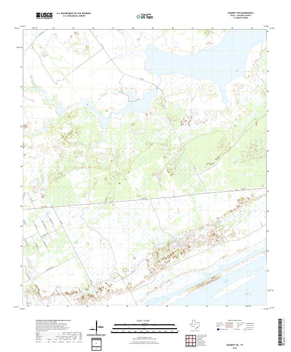
2022 Map of Seadrift NE
USGS Topo · Published 2022About this map
Intracoastal Waterway traffic and the expansive wetlands of the Texas Gulf Coast define this coastal landscape northeast of Seadrift. The map reveals a transition from the marine environments of Espiritu Santo Bay and Shoalwater Bay into a network of low-lying marshes and drainage systems, most notably Coloma Creek. A grid of rural roads in the southwest corner, including Wittnebert Rd, Carabajal Rd, and Morales Rd, marks a pocket of inland development and land tracts contrasting with the tidal flats to the east. The presence of FM 1289 and Adams St provides the primary transit corridors through this wetland-dominated terrain, which remains largely shaped by its proximity to the bay system.
Find a feature on this map
19 named features on this map. Tap any name to fly to it.
Don’t see what you’re looking for? This feature index may not catch every label — zoom into the map to look around manually.
Map Details
Editions of this 2022 Seadrift NE Map
This is the sole edition of this map. No revisions or reprints were ever made.
Other maps of this area

1951 · Keller Bay
USGS Topo · 1:24,000

1952 · Port Lavaca East
USGS Topo · 1:24,000

1952 · Mosquito Point
USGS Topo · 1:24,000

1952 · Pass Cavallo SW
USGS Topo · 1:24,000

1952 · Long Island
USGS Topo · 1:24,000

1952 · Seadrift NE
USGS Topo · 1:24,000

1952 · Seadrift
USGS Topo · 1:24,000

1952 · Port Lavaca West
USGS Topo · 1:24,000

1952 · Port O'Connor
USGS Topo · 1:24,000

1953 · Beeville
USGS Topo · 1:250,000