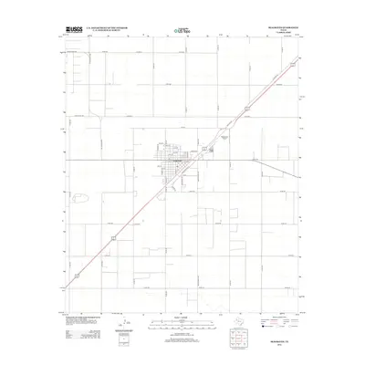
2012 Map of Seagraves
USGS Topo · Published 2012About this map
Seagraves stands as a primary hub of Gaines County, characterized by a grid-like street plan and its reliance on a network of agricultural and industrial roads. The 2012 landscape is defined by the intersection of major thoroughfares and regional routes like Ranch Road 1939 and Ranch Road 1780. Northeast of the central settlement, the Seagraves Airport provides a key point of infrastructure, while the diagonal path of Old Hwy 62 cuts across the gridded section lines. This arrangement reflects the classic West Texas settlement pattern, where town life is tightly clustered and surrounded by vast tracts of land organized by numbered county roads. Local utility history is hinted at by Light Plant Rd, while the residential core features an alphabetical and numerical street system, including Avenue K and 14th St, which speaks to the organized expansion of the community over time.
Find a feature on this map
50 named features on this map. Tap any name to fly to it.
Don’t see what you’re looking for? This feature index may not catch every label — zoom into the map to look around manually.
Map Details
Editions of this 2012 Seagraves Map
This is the sole edition of this map. No revisions or reprints were ever made.
Other maps of this area

1954 · Hobbs
USGS Topo · 1:250,000

1954 · Brownfield
USGS Topo · 1:250,000

1958 · Brownfield
USGS Topo · 1:250,000

1958 · Hobbs
USGS Topo · 1:250,000

1962 · Brownfield
USGS Topo · 1:250,000

1969 · Loop
USGS Topo · 1:24,000

1969 · Wellman
USGS Topo · 1:24,000

1970 · Seagraves SW
USGS Topo · 1:24,000

1970 · Seagraves SE
USGS Topo · 1:24,000

1970 · Seagraves
USGS Topo · 1:24,000