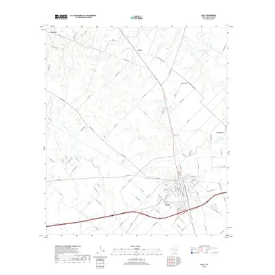
2019 Map of Sealy
USGS Topo · Published 2019About this map
The settlement of Sealy serves as a central hub on this Austin County landscape, where the intersection of Interstate 10 and multiple farm-to-market roads marks a point of modern transit. The terrain is defined by a dendritic network of waterways including Little Bernard Cr and Bullinger Cr, which wind through the rural surroundings of Millheim and Peters. To the east, the historic town of San Felipe sits near the banks of Mill Creek.
Find a feature on this map
108 named features on this map. Tap any name to fly to it.
Don’t see what you’re looking for? This feature index may not catch every label — zoom into the map to look around manually.
Map Details
Editions of this 2019 Sealy Map
This is the sole edition of this map. No revisions or reprints were ever made.
Other maps of this area

1953 · Seguin
USGS Topo · 1:250,000

1956 · Bellville
USGS Topo · 1:62,500

1956 · Sealy
USGS Topo · 1:62,500

1956 · Wallis
USGS Topo · 1:62,500

1957 · Eagle Lake
USGS Topo · 1:62,500

1958 · Seguin
USGS Topo · 1:250,000

1960 · Wallis
USGS Topo · 1:24,000

1960 · San Felipe
USGS Topo · 1:24,000
1960 · Rexville
USGS Topo · 1:24,000
1960 · Sealy
USGS Topo · 1:24,000