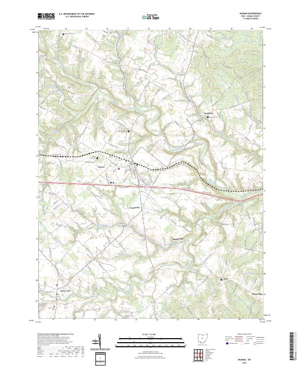
2023 Map of Seaman
USGS Topo · Published 2023About this map
Seaman serves as the primary hub of this Adams County landscape, situated at the intersection of local routes and the modern highway corridor. The settlement pattern follows the drainage of the West Fork Ohio Brush Creek, with smaller communities like Youngsville, Harshasville, and Tranquility distributed along the valley floors and surrounding ridges. The high density of family and community burial sites, including Mount Leigh Cem, Mount Zion Cem, and Tranquility Cem, suggests a deeply rooted agricultural heritage and established genealogical history for the region.
Find a feature on this map
108 named features on this map. Tap any name to fly to it.
Don’t see what you’re looking for? This feature index may not catch every label — zoom into the map to look around manually.
Map Details
Editions of this 2023 Seaman Map
This is the sole edition of this map. No revisions or reprints were ever made.