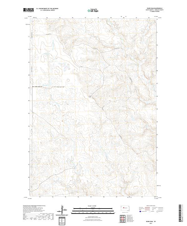
2021 Map of Sears Dam
USGS Topo · Published 2021About this map
Little Cottonwood Creek and its tributary, the E Fork Little Cottonwood Creek, define the drainage patterns of this Ziebach County landscape. These seasonal waterways are managed by local infrastructure such as Sears Dam and Campbell Dam, reflecting the agricultural water management critical to this prairie region. The terrain is lightly marked by a grid of rural routes, including Cherry Creek Rd and Sunnybrook Rd, which provide access to remote ranching parcels.
Find a feature on this map
15 named features on this map. Tap any name to fly to it.
Don’t see what you’re looking for? This feature index may not catch every label — zoom into the map to look around manually.
Map Details
Editions of this 2021 Sears Dam Map
This is the sole edition of this map. No revisions or reprints were ever made.
Other maps of this area

1954 · Pierre
USGS Topo · 1:250,000

1955 · Rattlesnake Lake
USGS Topo · 1:24,000

1955 · Rattlesnake Lake NE
USGS Topo · 1:24,000

1956 · Cherry Creek NW
USGS Topo · 1:24,000

1958 · Pierre
USGS Topo · 1:250,000

1981 · High Elk Hill NW
USGS Topo · 1:24,000

1981 · High Elk Hill SW
USGS Topo · 1:24,000

1982 · Miller Dam
USGS Topo · 1:24,000

1982 · Longbrake Ranch
USGS Topo · 1:24,000
1982 · Diermier Ranch
USGS Topo · 1:24,000