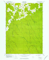
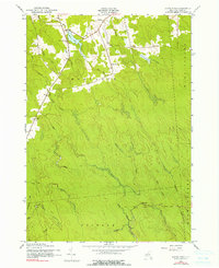
1943 Map of Sears Pond
USGS Topo · Published 1960About this map
Deer River and its numerous tributaries dominate this mid-century landscape in Lewis County, where the transition from forest to small-scale settlement is marked by isolated schoolhouses and small clusters like Edick and Parkers. The map captures a moment when rural infrastructure was still defined by numbered districts, featuring School Nos 3 & 8, School No 7, and School No 9 scattered across the townships of Montague and Martinsburg.
Find a feature on this map
26 named features on this map. Tap any name to fly to it.
Don’t see what you’re looking for? This feature index may not catch every label — zoom into the map to look around manually.
Map Details
Editions of this 1943 Sears Pond Map
5 editions found
Other maps of this area

1895 · Watertown
USGS Topo · 1:62,500

1898 · Watertown
USGS Topo · 1:62,500

1902 · Carthage
USGS Topo · 1:62,500

1903 · Orwell
USGS Topo · 1:62,500

1904 · Carthage
USGS Topo · 1:62,500

1905 · Orwell
USGS Topo · 1:62,500

1906 · Highmarket
USGS Topo · 1:62,500

1908 · Watertown
USGS Topo · 1:62,500

1909 · Watertown
USGS Topo · 1:62,500

1942 · Redfield
USGS Topo · 1:24,000