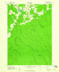
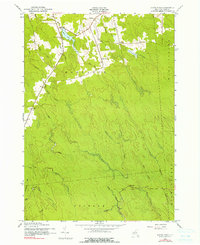
1943 Map of Sears Pond
USGS Topo · Published 1975About this map
Sears Pond sits at the heart of this Lewis County survey, which documents the sparsely populated upland drainages of the Tug Hill region during the early 1940s. The landscape is defined by an intricate network of waterways, including the Mad River and its various tributaries like North Branch Mad River and South Branch Mad River, alongside the East Branch Deer River. Small settlements and clusters of activity are scattered throughout the townships of Montague, Martinsburg, and Osceola, often centered around isolated rural institutions.
Find a feature on this map
26 named features on this map. Tap any name to fly to it.
Don’t see what you’re looking for? This feature index may not catch every label — zoom into the map to look around manually.
Map Details
Editions of this 1943 Sears Pond Map
5 editions found
Other maps of this area

1895 · Watertown
USGS Topo · 1:62,500

1898 · Watertown
USGS Topo · 1:62,500

1902 · Carthage
USGS Topo · 1:62,500

1903 · Orwell
USGS Topo · 1:62,500

1904 · Carthage
USGS Topo · 1:62,500

1905 · Orwell
USGS Topo · 1:62,500

1906 · Highmarket
USGS Topo · 1:62,500

1908 · Watertown
USGS Topo · 1:62,500

1909 · Watertown
USGS Topo · 1:62,500

1942 · Redfield
USGS Topo · 1:24,000