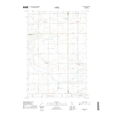
2019 Map of Sebeka NW
USGS Topo · Published 2019About this map
The Redeye River meanders across the southern landscape of this region where Becker, Otter Tail, and Wadena Counties meet. This 2019 survey documents a rural environment defined by its watercourses and small family cemeteries. To the north, the Kettle River flows through a terrain marked by wetlands and man-made drainage systems like County Ditch Number Twentyseven. Genealogists will find several burial sites recorded, including Red Eye Cem, Grace Cem, and Bethania Lutheran Cem, which sits near the junction of Co Hwy 8. The map also reveals the local road network connecting dispersed homesteads, with named routes such as Tamarack Hollow Ln and Lattinen Rd providing access across the low-lying terrain around Mud Lake.
Find a feature on this map
61 named features on this map. Tap any name to fly to it.
Don’t see what you’re looking for? This feature index may not catch every label — zoom into the map to look around manually.
Map Details
Editions of this 2019 Sebeka NW Map
This is the sole edition of this map. No revisions or reprints were ever made.
Other maps of this area

1953 · Brainerd
USGS Topo · 1:250,000

1957 · Brainerd
USGS Topo · 1:250,000

1958 · Brainerd
USGS Topo · 1:250,000

1965 · Brainerd
USGS Topo · 1:250,000

1969 · Wolf Lake
USGS Topo · 1:24,000

1969 · Sebeka SW
USGS Topo · 1:24,000

1969 · Menahga
USGS Topo · 1:24,000

1969 · Park Rapids SW
USGS Topo · 1:24,000

1969 · Sebeka
USGS Topo · 1:24,000

1969 · Sebeka NW
USGS Topo · 1:24,000