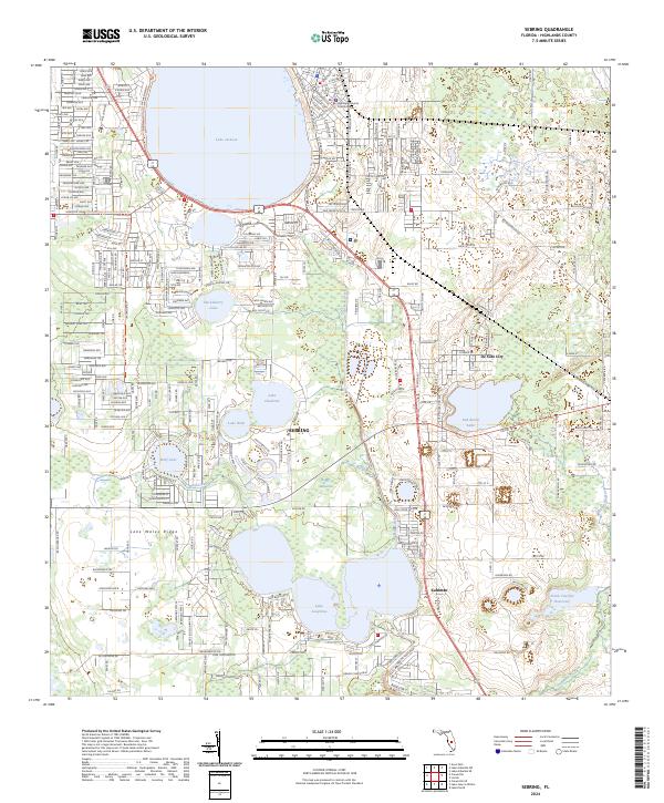
2024 Map of Sebring
USGS Topo · Published 2024About this map
Sebring serves as the focal point of this Highlands County region, where the urban grid meets the distinct ecological zones of the Lake Wales Ridge. The map details the civic heart of the area at the Highlands County Courthouse, surrounded by an extensive network of freshwater bodies including the large Lake Jackson and the more secluded Lake Josephine. This modern topography highlights the balance between residential development and environmental preservation, clearly marking the boundaries of the Lake Wales Ridge National Wildlife Refuge. Transportation routes like US Hwy 27 98 and FL Hwy 66 anchor the local geography, while recreational paths such as the Highlands Hammock State Park Trl and Highlands County Trl reveal the area's contemporary landscape of conservation and connectivity.
Find a feature on this map
31 named features on this map. Tap any name to fly to it.
Don’t see what you’re looking for? This feature index may not catch every label — zoom into the map to look around manually.
Map Details
Editions of this 2024 Sebring Map
This is the sole edition of this map. No revisions or reprints were ever made.
Other maps of this area

1952 · Lake Placid
USGS Topo · 1:24,000

1952 · Lake Arbuckle SW
USGS Topo · 1:24,000

1952 · Lake Arbuckle SE
USGS Topo · 1:24,000

1952 · Lorida
USGS Topo · 1:24,000

1952 · Sebring
USGS Topo · 1:24,000

1953 · Avon Park
USGS Topo · 1:24,000

1953 · Lake June In Winter
USGS Topo · 1:24,000

1953 · Crewsville SE
USGS Topo · 1:24,000

1953 · Crewsville
USGS Topo · 1:24,000

1956 · Fort Pierce
USGS Topo · 1:250,000