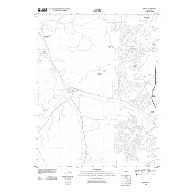
2010 Map of Sedalia
USGS Topo · Published 2010About this map
Sedalia serves as the focal point for this section of Douglas County, situated at the confluence of Plum Creek and West Plum Creek. The landscape transition is evident where the high-density residential developments of Castle Pines North and Surrey Ridge meet the more open, traditional land uses to the west. Industrial history remains visible through the Ute Mine near Cherokee Mountain and the MYM Mine in the southeast corner. Transportation and local aviation are well-represented by the Littleton-Sedalia Landing Area and the Denver-Douglas Landing Strip. The presence of the Sacred Heart Retreat House and Happy Canyon Ranch suggests a region that balances religious and recreational institutions with the rapid suburban expansion of the early 21st century.
Find a feature on this map
50 named features on this map. Tap any name to fly to it.
Don’t see what you’re looking for? This feature index may not catch every label — zoom into the map to look around manually.
Map Details
Editions of this 2010 Sedalia Map
This is the sole edition of this map. No revisions or reprints were ever made.
Other maps of this area

1890 · East Denver
USGS Topo · 1:125,000

1893 · Platte Canyon
USGS Topo · 1:125,000

1894 · Castle Rock
USGS Topo · 1:125,000

1899 · West Denver
USGS Topo · 1:125,000

1913 · Castle Rock
USGS Topo · 1:125,000

1935 · East Denver Nos. 3 and 4
USGS Topo · 1:48,000

1940 · Castle Rock
USGS Topo · 1:62,500

1942 · Highland Ranch
USGS Topo · 1:31,680

1942 · Parker
USGS Topo · 1:31,680

1942 · Littleton
USGS Topo · 1:31,680