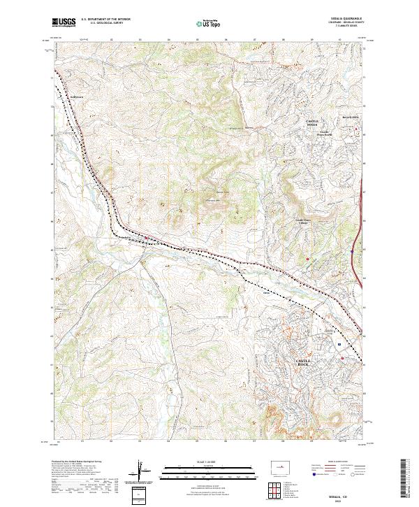
2022 Map of Sedalia
USGS Topo · Published 2022About this map
The confluence of Plum Cr and Jarre Cr anchors this modern Douglas County landscape, where the historic community of Sedalia remains a central waypoint. The terrain is defined by prominent topographical landmarks like Cherokee Mtn and Racoon Knob, while residential development clusters at Castle Pines Village and Castle Pines North. The presence of the Arapahoe Community College campus near the northern edge of Castle Rock indicates the area's continued growth as a suburban and educational hub. Transport remains dominated by the Santa Fe Dr corridor, which follows the natural valley past Orsa and Kellytown. Recreational footprints are visible through the East Plum Creek Trl and Daniels Park Trl, tracing the edges of ridges such as Wildcat Point and the deep cut of Jarre Canyon.
Find a feature on this map
40 named features on this map. Tap any name to fly to it.
Don’t see what you’re looking for? This feature index may not catch every label — zoom into the map to look around manually.
Map Details
Editions of this 2022 Sedalia Map
This is the sole edition of this map. No revisions or reprints were ever made.
Other maps of this area

1890 · East Denver
USGS Topo · 1:125,000

1893 · Platte Canyon
USGS Topo · 1:125,000

1894 · Castle Rock
USGS Topo · 1:125,000

1899 · West Denver
USGS Topo · 1:125,000

1913 · Castle Rock
USGS Topo · 1:125,000

1935 · East Denver Nos. 3 and 4
USGS Topo · 1:48,000

1940 · Castle Rock
USGS Topo · 1:62,500

1942 · Highland Ranch
USGS Topo · 1:31,680

1942 · Parker
USGS Topo · 1:31,680

1942 · Littleton
USGS Topo · 1:31,680